Imagery © Mapbox © OpenStreetMap © Maxar. Improve this map.

YooNee!: From Everyday Wayfinding to Crisis-Ready Platform

One campus. Two stress tests.

YooNee! began as KMITL’s own platform for navigating a campus split into four zones. Three weeks after a six-day Expo, the living lab adapted within the same day to carry flood information and live camera access. At the campus shelter, staff showed evacuees how to use it to find services on their own.

  • more than124,065Expo visitors
  • more than78,471walking-route requests, 31 Aug–6 Sep 2026
  •  Same dayadapted when the flood came
  • at least109,125live camera views, 26 Sep–3 Oct 2026

How each figure was counted is noted beside it on this page.

Satellite view of Suvarnabhumi Airport, KMITL and the Lat Krabang Industrial Estate

At KMITL, the Eastern Line railway crosses Chalong Krung Road, part of the route between Suvarnabhumi Airport and the Lat Krabang Industrial Estate, and together they split the campus into four zones.

Imagery © Mapbox © OpenStreetMap © Maxar.

Main walking routes, simplified from the 36 km network KMITL surveyed itself.

Imagery © Mapbox © OpenStreetMap © Maxar. Improve this map.

A live railway and Chalong Krung Road, part of the route between Suvarnabhumi Airport and the Lat Krabang Industrial Estate, split KMITL into four zones. Crossing on foot means crossing tracks and traffic. Those with least margin suffer most: first-time visitors, older people, students who need ramps and lifts, anyone caught in heat or heavy rain.

Faculties, schools and units sit in every zone.

Trains, buses, bicycles and boats belong to different operators who share no single picture.

KMITL’s answer was one operating platform the institution runs itself, joining every operator with its own surveyed paths, shuttle, sensors and cameras.

The innovation is the platform, not the map.

The innovation is the mechanism, not a product. KMITL, through SCiRA (Smart City Innovative Research Academy), built YooNee! as an adaptive operating platform and runs it as a living lab. Public and private operators feed it through connectors: the State Railway of Thailand supplies train timetables; Thai Smile Bus, live positions of its electric buses; Anywheel, shared-bicycle points; TTA Mariner, electric boats. KMITL supplies its surveyed paths and facilities, campus shuttle, environmental sensors and cameras.

The back office can change content and live conditions at any time, while people keep the same interface. It runs on KMITL’s existing infrastructure and team: no new capital investment, no hiring and no paid map licence.

YooNee operating platform: inputs and modesPublic, private and KMITL data sources feed one operating platform run by KMITL, which adapts to each situation, so far Everyday, KMITL EXPO 2026 and Flood response.State Railway of Thailandtrain timetablesThai Smile Buslive electric-bus positionsAnywheelshared-bicycle pointsTTA Marinerelectric boatsSurveyed walking pathscampus-specific routesCampus facilitiestoilets, water, AED, ramps, canteensCampus shuttlelive positionsEnvironmental sensorsair quality, temperature, humidity, noise, lightCameraslive road viewsPUBLIC SECTORPRIVATE SECTORKMITLEVERYDAYEVENTCRISISYooNee!adaptive operating platformExisting KMITL infrastructure· no new capital investment ·back office switches modesONE PLATFORM, ADAPTABLE MODESEverydaywayfinding, transit and campus servicesrail, bus, bicycle, boat, shuttleKMITL EXPO 202631 August–6 September 2026more than 78,471 walking-route requestsFlood responseswitched the same day, 26 Septemberat least 109,125 live camera viewsYooNee operating platform: inputs and modesPublic, private and KMITL data sources feed one operating platform run by KMITL, which adapts to each situation, so far Everyday, KMITL EXPO 2026 and Flood response.State Railway of Thailandtrain timetablesThai Smile Buslive electric-bus positionsAnywheelshared-bicycle pointsTTA Marinerelectric boatsSurveyed walking pathscampus-specific routesCampus facilitiestoilets, water, AED, ramps, canteensCampus shuttlelive positionsEnvironmental sensorsair, temperature, humidity, noise, lightCameraslive road viewsPUBLIC SECTORPRIVATE SECTORKMITLEVERYDAYEVENTCRISISYooNee!adaptiveoperating platformExisting KMITL infrastructure· no new capital investment ·back office switches modesONE PLATFORM, ADAPTABLE MODESEverydaywayfinding, transit and campus servicesrail, bus, bicycle, boat, shuttleKMITL EXPO 202631 August–6 September 2026more than 78,471 walking-route requestsFlood responseswitched the same day, 26 Septemberat least 109,125 live camera views
How the platform is put together.

Six days at campus scale

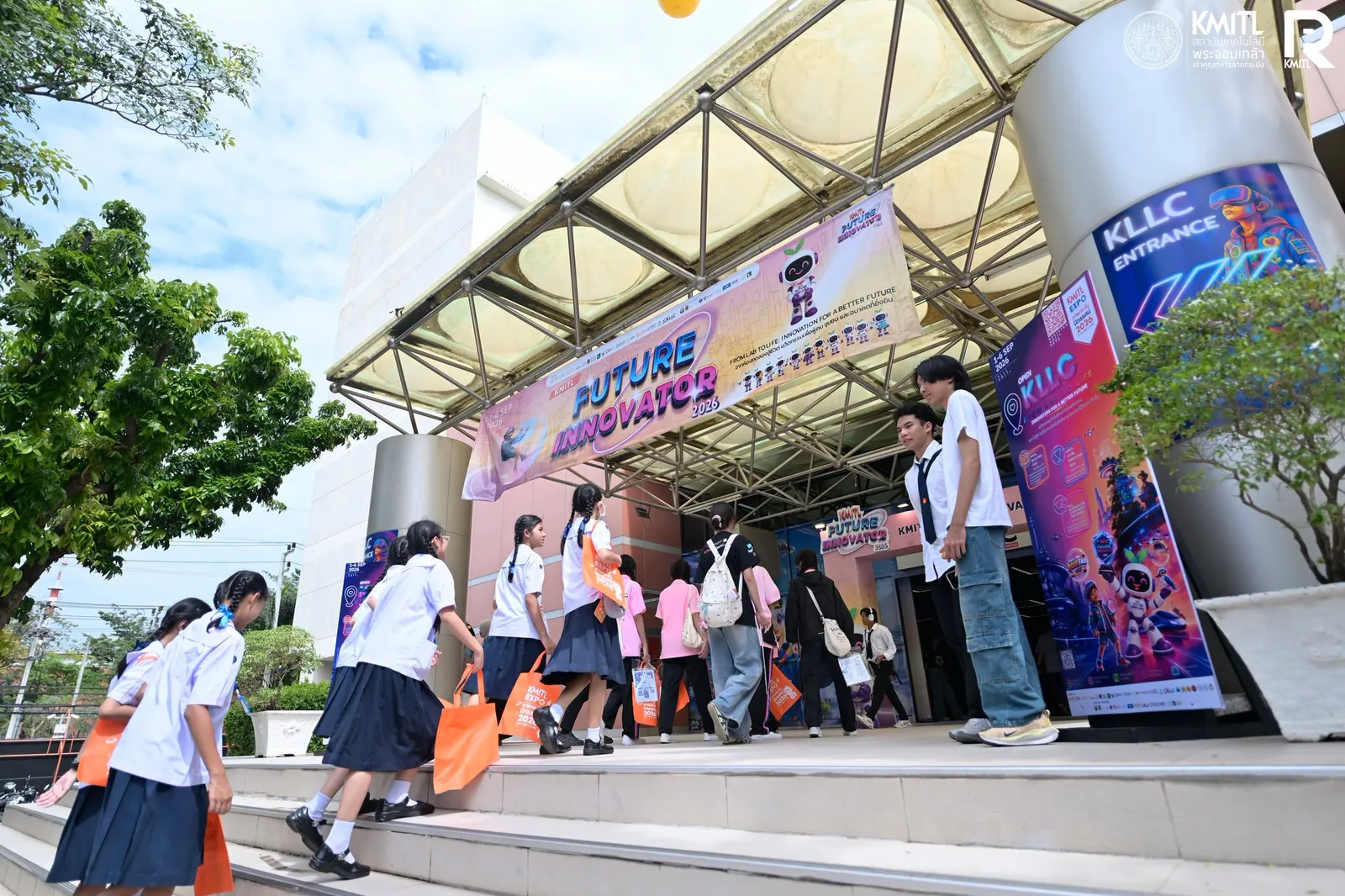
Expo crowd beside daily route, App Store and Google Play figures: visitors in school uniform climb steps beneath the Future Innovator banner at the KLLC entrance.
KMITL Expo 2026, 1–6 September. Photo: KMITL.
  • From 1–6 September 2026, KMITL Expo brought more than

    124,065

    visitors to a campus-wide event

    How measured

    Source: KMITL press release, 14 September 2026. KMITL reported the Expo attendance as more than 124,065.

  • From 31 August to 6 September YooNee! handled more than

    78,471

    walking-route requests

    How measured

    Source: YooNee platform operations records, 31 August to 6 September 2026. Counts requests received by the walking-route service, not people.

  • Institute vans, buses and hired vans carried

    4,274

    passengers over the six days

    How measured

    Source: KMITL Expo 2026 central operations summary (KMITL), transport figures.

  • During the event window, App Store Connect and Google Play recorded

    2,832 / 2,959

    iOS first downloads / Google Play new installs

    How measured

    Sources: App Store Connect daily sales reports (iOS first downloads) and Google Play Console installs report (daily user installs), both 1–6 September 2026. The two stores define these figures differently, so they are not added together.

Daily App Store first downloads and Google Play new installs, 1–6 September 2026

1 Sep2 Sep3 Sep4 Sep5 Sep6 SepApp Store first downloadsGoogle Play new installs1 Sep2 Sep3 Sep4 Sep5 Sep6 SepApp Store first downloadsGoogle Play new installs

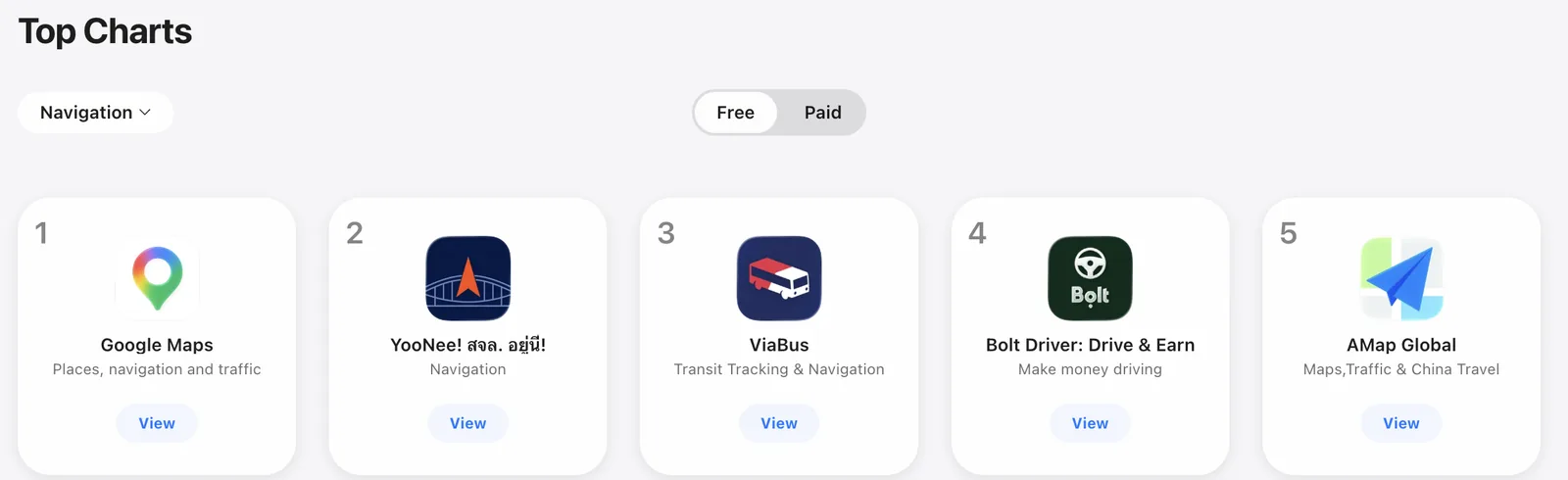
A captured App Store chart placed YooNee No. 2 in Navigation (Free).

App Store Top Charts for Navigation, Free: YooNee ranked second.
App Store, Top Charts — Navigation (Free), 4 September 2026.

Imagery © Mapbox © OpenStreetMap © Maxar. Improve this map. Camera points: KMITL Disaster Management and Safety Center.

Then the question changed

Three weeks later, the living lab stopped being an experiment. Floods hit much of Thailand; all 50 Bangkok districts were declared disaster areas, and low-lying Lat Krabang, home to KMITL, stayed badly affected from 26 September into October.

“How do I get there?” became “Can I get there safely?”

KMITL, September 2026.

The platform changed role that day

07:05Round-the-clock camera operations began.

MorningAccess to additional camera feeds was secured.

About 13:40Existing traffic cameras went live in YooNee as flood monitors.

Same dayThe home feed switched to flood information, including shelters, tow trucks and the command centre.

Ready for the unexpected

When the flood came, YooNee! changed what it showed within the same day, on the app people already had. Nobody had to install anything.

Expo

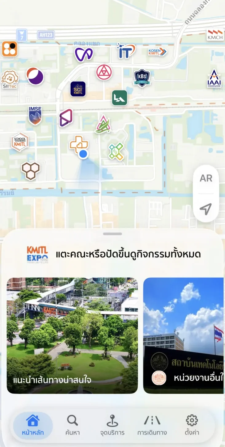
YooNee home screen with faculty logos on the map and KMITL Expo event cards.
YooNee home screen set up for KMITL Expo, August 2026.

Flood

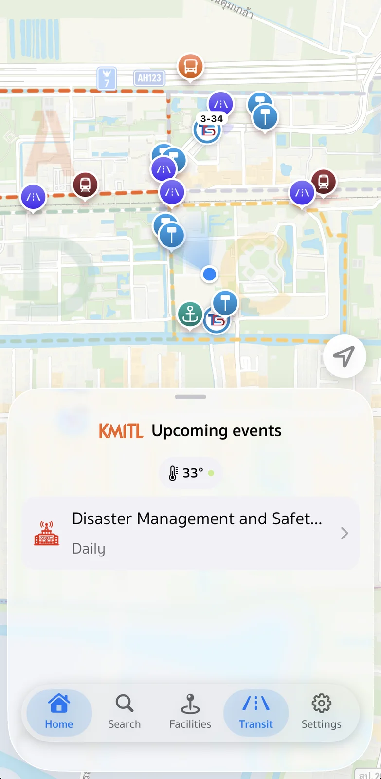
YooNee home screen listing the KMITL Disaster Management and Safety Center under upcoming events.
YooNee home screen during the flood, 3 October 2026.
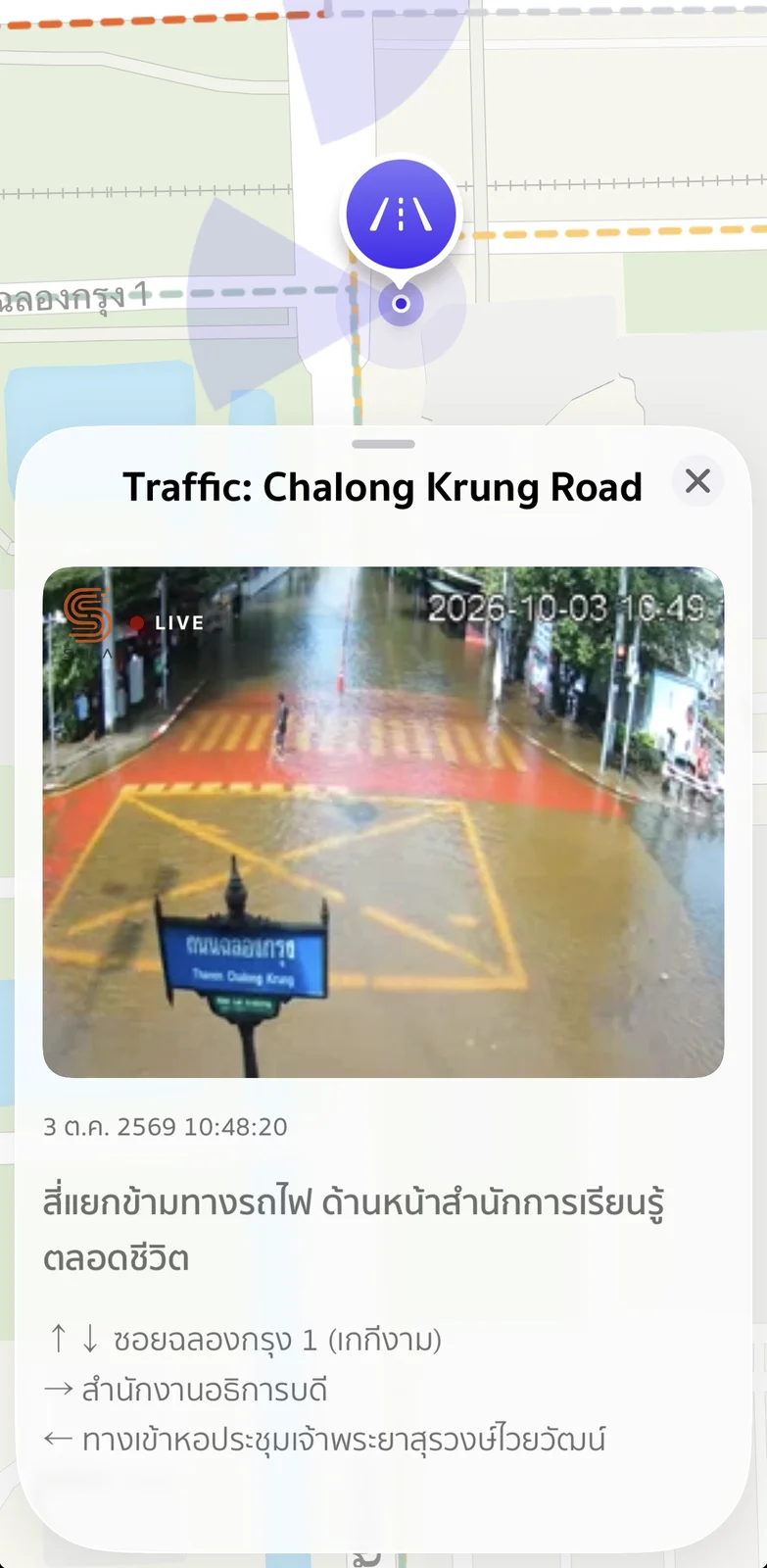
YooNee live camera: flooded railway-crossing junction in front of the Lifelong Learning office.
A live camera in YooNee, 3 October 2026.
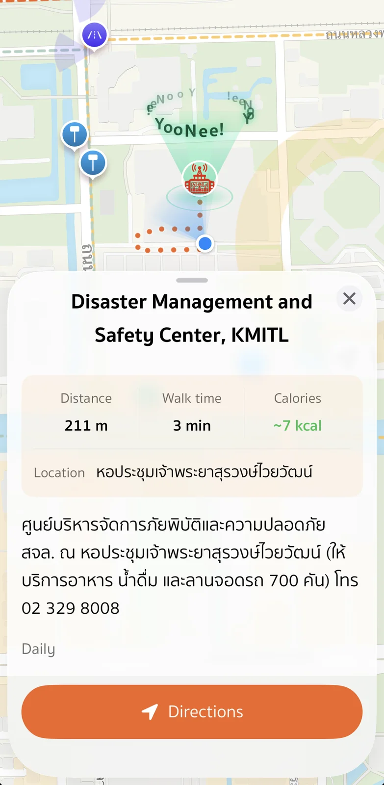
YooNee walking route to the Disaster Management and Safety Center: 211 metres, about 3 minutes.
Directions to the KMITL Disaster Management and Safety Center, 3 October 2026.

People came for live conditions

From 26 September to 3 October 2026, people opened the live cameras at least 109,125 times and made at least 20,653 route and facility requests.

How measured

Source: YooNee platform operations records, 26 September to 3 October 2026. One view = one camera opened in the app; counts requests, not people.

App Store first downloads: 1,845 during the flood week.

Flood information added 807 1,845 20–24 Sep 25 Sep – 1 Oct
How measured

Source: App Store Connect daily sales reports, iOS first downloads. 25 September to 1 October: 1,845 (peak 807 on 26 September). For comparison, 20 to 24 September: 7.

Google Play figures for the flood period were not yet available at the time of submission; Play data runs to 20 September 2026.


Public communication

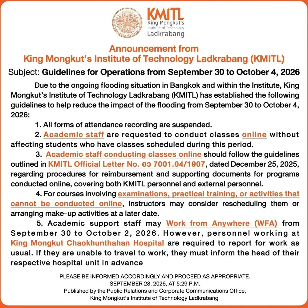
KMITL public notice on operations from 30 September to 4 October 2026.
KMITL public notice, 28 September 2026, on operations during the flood.

On 29 September 2026, a KMITL notice directed people to YooNee’s live cameras.

A mobility asset became a relief asset

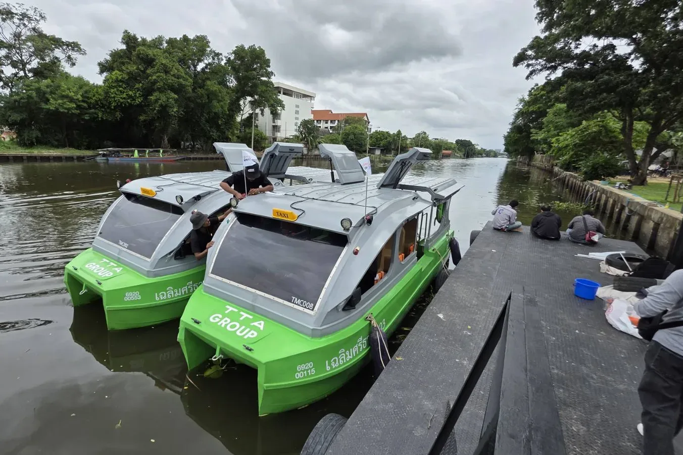
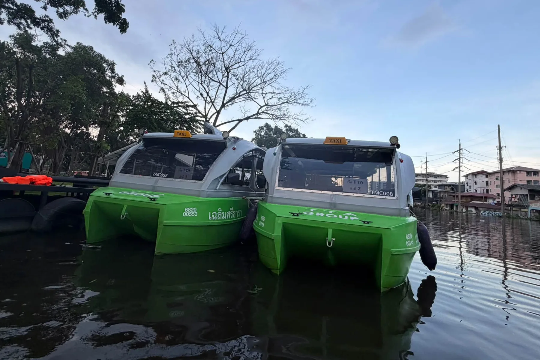
Two green TTA Group electric boats, hull numbers TMC002 and TMC008, moored at the KMITL Expo rail-boat trial.
KMITL Expo rail-boat trial, 31 August 2026. Photo: SCIRA KMITL.
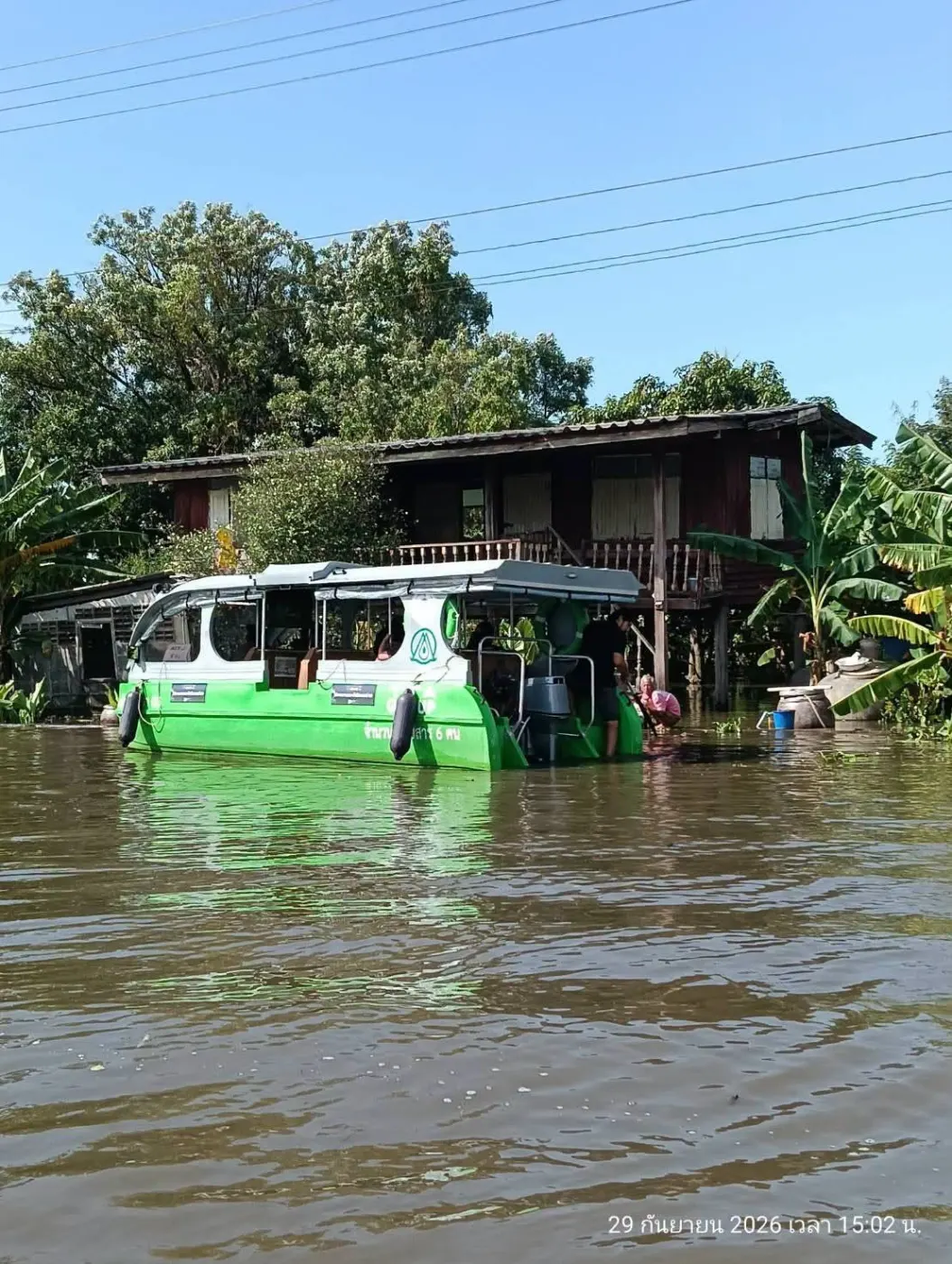
The same two green TTA Group electric boats, hull numbers TMC002 and TMC008, in the floodwater.
The same boats, TMC002 and TMC008, in the floodwater. Photo: KMITL.

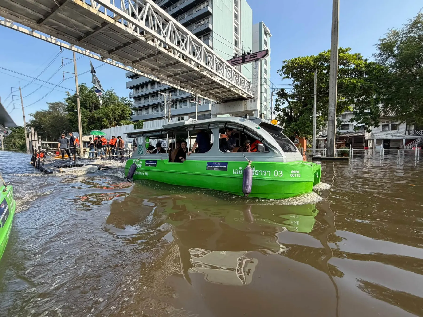
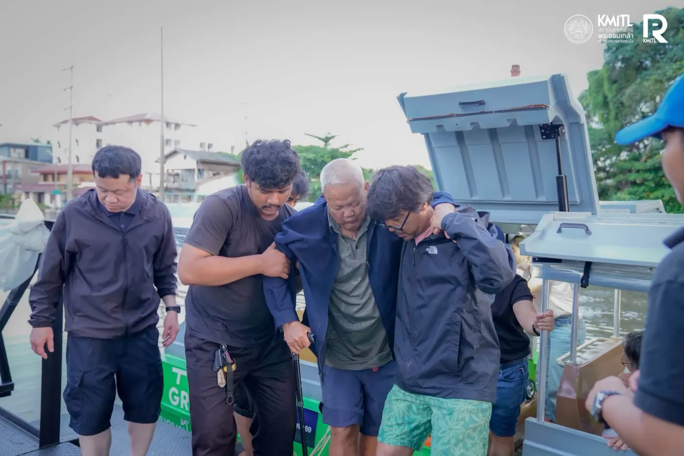
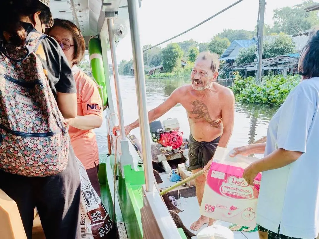
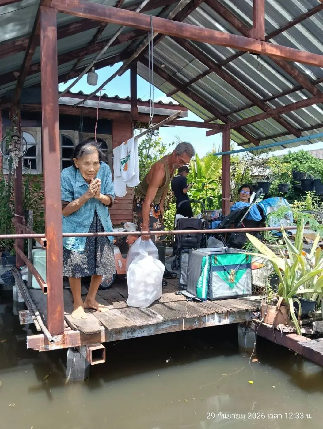
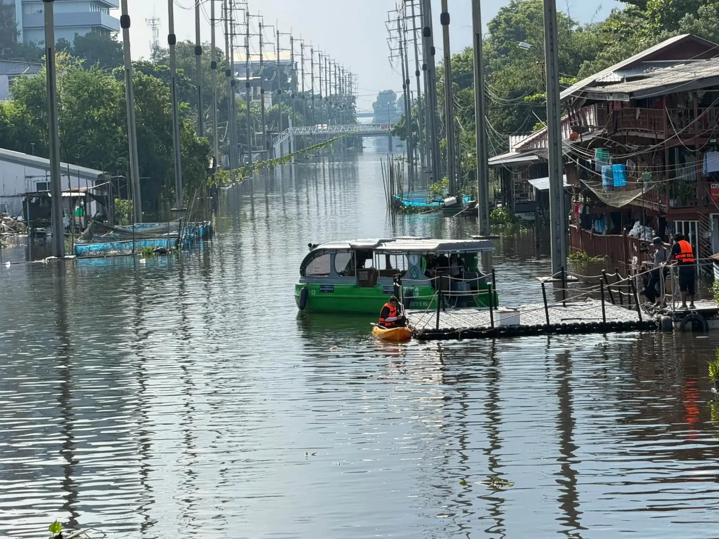
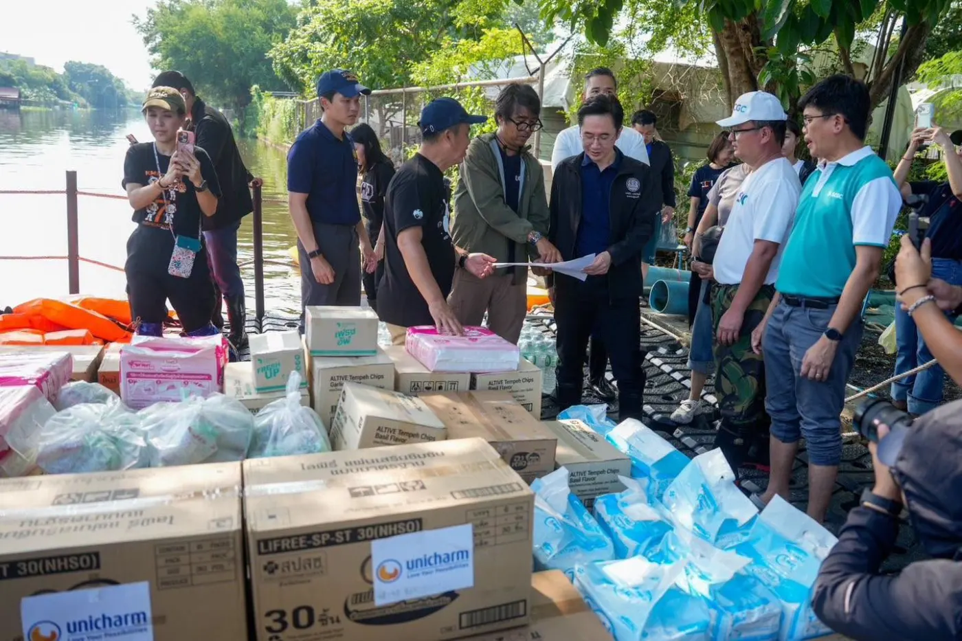
YooNee displayed the positions of TTA Mariner’s electric boats during the Expo. Weeks later the same two boats were photographed in the floodwater, and TTA’s electric boats helped evacuate elderly residents and carried relief supplies to flooded communities. A partnership built for everyday mobility was ready when the water rose.

A green electric boat on a flooded road beneath a pedestrian bridge.
An electric boat on a flooded road, late September 2026.
  • Staff helping an elderly man beside a green boat.
  • A resident receiving a pack handed over from a boat.
  • An elderly resident on a flooded house porch with bags of relief supplies.
Helping residents and delivering relief by electric boat.
  • A boat and a raft on a long flooded street lined with poles.
  • A green boat beside a flooded wooden house.
  • Boxes of relief supplies at a riverside handover, with staff.
Boats reached flooded homes; relief supplies were handed over.
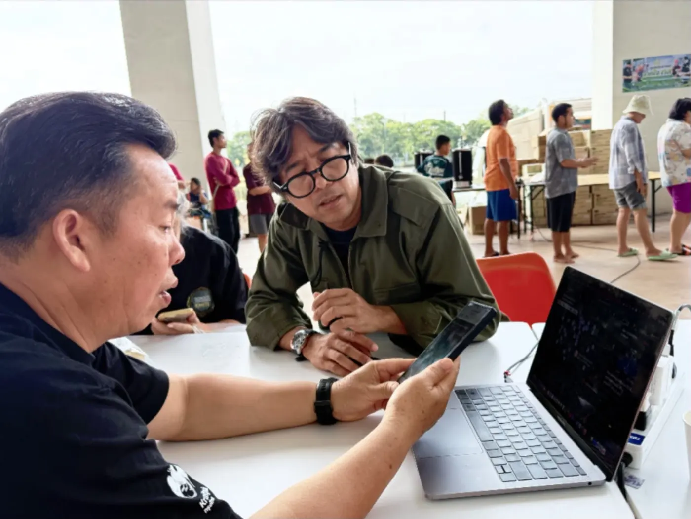
  • Two staff members coordinating at a table with a phone and a laptop.
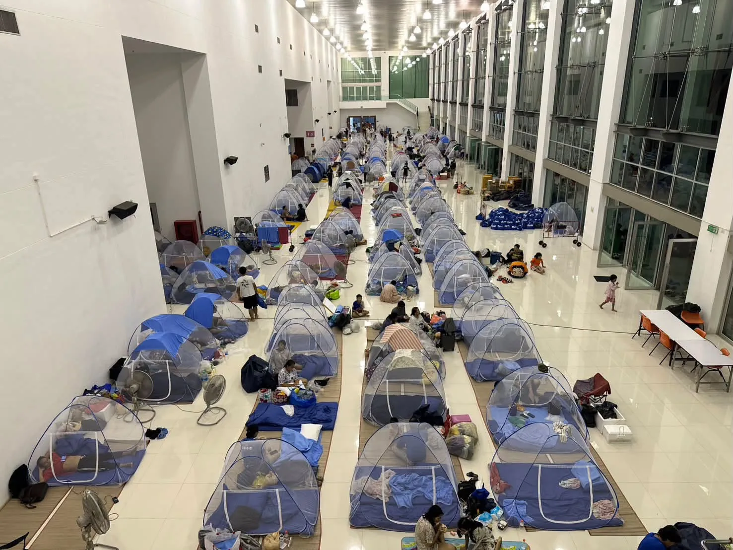
  • Rows of mosquito-net tents in a shelter hall.
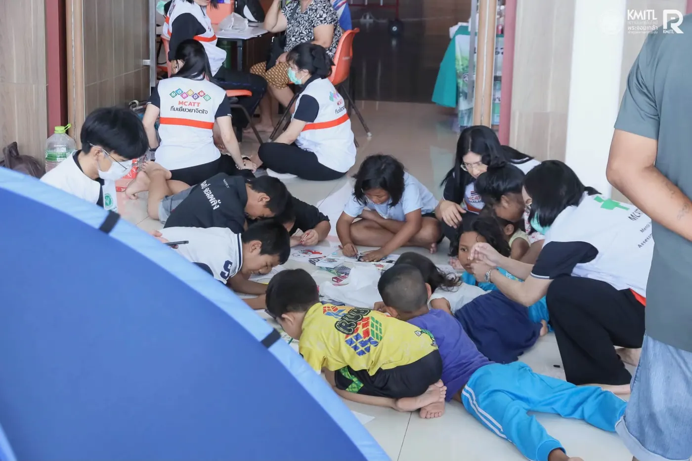
  • Children drawing on the shelter floor with volunteers.
Coordination and the KMITL shelter.

Photos: KMITL, late September to early October 2026.

Finding help at the shelter

KMITL opened its halls as a shelter for more than 750 residents of the surrounding area. Inside, evacuees used the same platform that had guided Expo visitors three weeks earlier, with staff showing them how. With no account needed, anyone could find the nearest toilets, drinking water, canteens, AED units and ramps, each with its distance and a walking route from where they stood.

Searching for services in YooNee.
Every canteen in one list, with walking distance.

How searching for services works in the app (screen recording from KMITL Expo 2026); evacuees at the shelter used the same steps.

Staff guidance and KMITL notices during the flood, late September 2026.

Privacy stayed part of the design

YooNee requires no account or login.

Apple’s privacy label states

“Data Not Collected”

Apple App Store privacy label, as declared by the developer.

Google Play states

“No data collected”

and

“No data shared with third parties”

Google Play Data Safety, as declared by the developer.
Everyday

Imagery © Mapbox © OpenStreetMap © Maxar. Improve this map.

Expo

Imagery © Mapbox © OpenStreetMap © Maxar. Improve this map.

Flood

Imagery © Mapbox © OpenStreetMap © Maxar. Improve this map. Camera points: KMITL Disaster Management and Safety Center.

What another institution would need

  1. Trace how people actually move

    Paths, entrances, crossings and campus-specific destinations.

  2. Connect existing services

    Rail, buses, shuttles, bicycles, boats, facilities and live conditions.

  3. Keep operational content apart from the app

    A back end and back office that change what people see without a new app version.

  4. Build privacy into how it runs

    No accounts, minimal data, de-identified camera images.

The transferable element is not KMITL’s exact map. It is the institution-run mechanism: trace movement at place level, connect existing public and private services, keep operational content configurable and institution-owned, and design for privacy.

Everyday wayfinding became crisis-ready infrastructure

YooNee began by solving a deceptively simple university problem: helping people move through a campus that conventional maps only partly understand.

At KMITL Expo 2026 it operated at campus-wide scale. Weeks later, the same platform changed its operating mode within the same day to support flood information and live conditions, without asking anyone to learn or install a different system.

The lesson is larger than one app or one campus. Resilience here means an existing platform that adapts within a day when the unexpected arrives.

Download on the App Store Get it on Google Play

YooNee! is developed by SCIRA, King Mongkut’s Institute of Technology Ladkrabang, with State Railway of Thailand, Thai Smile Bus, Anywheel and TTA / TTA Mariner.

Map data © OpenStreetMap contributors. Photos: KMITL, SCIRA KMITL, TTA. Satellite imagery: Mapbox.